Old Map of Latin America
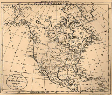
Who did the map favor?Since this map is from 1797, that means that the Northwest Territory in the United States was already formed since the American Revolutionary War lasted from 1775-1783. This means that as far as the southwestern sections of the country went, it was mostly populated and controlled by Mexico. Taking into account the Louisiana purchase of 1803, France still controlled the middle section of North America
What has happened since, and who was affected?Since this map of 1797, a lot has happened regarding the placement of territories/ states as well as the cultural shift that comes with borders and shifting lines. Now Mexico is moved further downwards and into what is now the Mexico we all know, all while states like California and Texas have slowly created what is now our border with Latin America. Canada has also claimed a more distinct territory since then and of course now the United States belongs to the American people rather than Britain or France.
|
|
